Moving to Baltimore, MD 21219
At the tip of the Patapsco Neck, 21219 covers Edgemere and Sparrows Point, where the old Bethlehem Steel works has become the Tradepoint Atlantic logistics campus. Residential streets are mostly modest single-family homes and waterfront lots along Bear Creek, Jones Creek and the Chesapeake shoreline. North Point Boulevard and I-695 connect the peninsula to Dundalk and the rest of Baltimore County.
Check another place
Baltimore, MD 21219 at a glance.
ZIP 21219, Baltimore County. Tap a card for the details.
- Safety
 No data for this ZIPSee the map
- Walkability
 6.6Below average walkableEPA index, out of 20See the map
- Grocery
 Trader Joe'sover 2 miWhole Foodsover 2 miMOM's Organicover 2 miSee the map
- Restaurants
 Coming soonSee the list
- Cafes
 Coming soonSee the list
- Schools
 22schoolswithin 5 miles · 21 public, 1 privateSee the list
- Climate & Air
 Coming soonSee the weather
- People
 9,605residentsmedian household income $116,000See the data
Reported crime around 21219.
Reported incidents from police data. A map shows where they happened; numbers alone can't tell one block from the next.
Life without a car around 21219.
Grocery stores and Metro stations near Baltimore, MD. Pick a store to see only that chain.
1 grocery store and 0 Metro stations within 2 miles of 21219
- Grocery store
- Metro station
Nearest grocery stores
- Food Lion7514 N Point Rd, Edgemere1.3 mi
Nearest Metro stations
No Metro stations within 2 miles.
Source: USDA SNAP Retailer Locator and WMATA via DC GIS · supermarkets that accept SNAP; distances are straight-line from the center of 21219. Store icons are each chain's own website icon. Updated 2026-10-26.
Grocery stores within 1 mile
0
You'll likely drive to shopNearest: Food Lion, 1.3 mi
Nearest Metro station
28.3 mi
A short drive or bus rideGreenbelt
EPA Walkability Index
6.6 / 20
Below average walkableAverage of 6 Census block groups within about half a mile
The EPA National Walkability Index scores every U.S. neighborhood from 1 to 20 on connected streets, nearby transit and the mix of shops, jobs and homes: above 15 is among the most walkable places in the country, below 6 usually means driving for most errands.
The most popular places to eat near 21219.
The busiest restaurants within about a mile and a half of Baltimore, by number of Google reviews. "Must visit" means 4.6 stars or better from 1,000+ reviews.
The most popular coffee near 21219.
The busiest cafes and coffee shops within about a mile and a half of Baltimore, by number of Google reviews. "Must visit" means 4.6 stars or better from 500+ reviews.
Schools within 5 miles.
Public and private schools from the U.S. Department of Education, closest first.
Elementary
11
Middle
4
High
7
Public / private
21 / 1
Closest schools
Sparrows Point Middle
public · middle · grades 06–08
0.6 mi
Chesapeake Terrace Elementary
public · elementary · grades PK–05
0.6 mi
Sparrows Point High
public · high · grades 09–12
0.6 mi
Edgemere Elementary
public · elementary · grades PK–05
0.7 mi
Sandy Plains Elementary
public · elementary · grades PK–05
3.0 mi
Battle Grove Elementary
public · elementary · grades PK–05
3.1 mi
Bear Creek Elementary
public · elementary · grades PK–05
3.3 mi
Patapsco High and Center for Arts
public · high · grades 09–12
3.4 mi
OUR LADY OF HOPE ST LUKE SCHOOL
private · elementary
3.7 mi
Battle Monument School
public · high · grades PK–12
3.7 mi
Charlesmont Elementary
public · elementary · grades PK–05
3.7 mi
Grange Elementary
public · elementary · grades PK–05
3.9 mi
Source: NCES Common Core of Data and Private School Survey.
Weather and air in Baltimore.

51 AQI
ModerateCurrent reading
8.3 µg/m³
Under the EPA standardEPA annual standard: 9 µg/m³
Weather and air quality from Open-Meteo.
Who lives in 21219.
U.S. Census Bureau, American Community Survey 2022 5-year estimates.
9,605
Small-town feel
44.9
Older populationU.S. average 38.9

$116,000
Upper-middle incomesU.S. average $74,580
$348,900
Established marketU.S. average $281,900
$1,416/mo
City-level rentsU.S. average $1,402/mo

86.2%
Mostly homeownersU.S. average 64.7%

27.1%
Mixed backgroundsU.S. average 35.4%
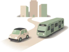
26.9 min
Typical commuteU.S. average 26.4 min
How Baltimore County voted
Presidential elections, share of all votes cast in the county.
- 2024Latest
- Harris
- 60.5%
- Trump
- 36.2%
- Other
- 3.2%
Nationwide: Harris 48.3%, Trump 49.8%
- 2020
- Biden
- 62.3%
- Trump
- 35.2%
- Other
- 2.5%
Nationwide: Biden 51.3%, Trump 46.8%
- 2016
- Clinton
- 55.9%
- Trump
- 38.3%
- Other
- 5.8%
Nationwide: Clinton 48.2%, Trump 46.1%
Source: MIT Election Data and Science Lab, County Presidential Election Returns 2000-2024. County-wide results, not this ZIP alone.
Moving to Baltimore 21219: what to know.
- Townhouse and HOA communities often limit where a moving truck can park, and for how long. Check your HOA rules for both homes before moving day.
- Apartment and condo buildings usually ask for a certificate of insurance and a reserved freight elevator or loading dock time. Ask your building early, for both the old place and the new one.
- The Beltway, I-270 and I-95 make moving-day timing hard to predict. With a flat rate, traffic costs you time, not money.
Local moves in 21219 start at $240 for a 1-bedroom apartment and $780 for a 2-bedroom house. One flat rate, no deposit.
FAQ
Baltimore 21219,
questions answered.
Straight answers about 21219, from the same public data as the report above.
Talk with Red Cat- 21219 scores 6.6 out of 20 on the EPA National Walkability Index (below average walkable). There are no supermarkets within a mile of the center of the ZIP, so most people drive to shop.
Neighborhoods near 21219
Know your price.
Then let's move.
Your stuff moves. Your price doesn't.
Trusted by local people and businesses.